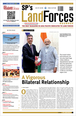
INDIAN ARMED FORCES CHIEFS ON
OUR RELENTLESS AND FOCUSED PUBLISHING EFFORTS
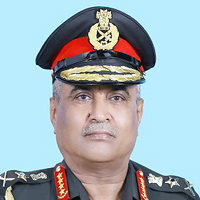
SP Guide Publications puts forth a well compiled articulation of issues, pursuits and accomplishments of the Indian Army, over the years
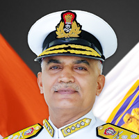
I am confident that SP Guide Publications would continue to inform, inspire and influence.
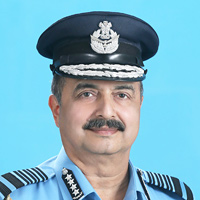
My compliments to SP Guide Publications for informative and credible reportage on contemporary aerospace issues over the past six decades.
- Interim Defence Budget 2024-25 — An Analysis
- Union Defence budget 2024
- Indian Army: In quest of greater firepower and policy recommendations for gaps
- Indian Army Annual Press Conference 2024
- 6G will transform military-industrial applications
- Tata Boeing Aerospace Delivers 250 AH-64 Apache Fuselages, Manufactured in India
‘Any decision for induction of F-INSAS or BMS will only be taken after both the systems have been field tested’

SP’s Land Forces team comprising Jayant Baranwal, Editor-in-Chief and Lt General V.K. Kapoor, Editor, had a tête-à-tête with Lt General N.B. Singh, on a range of issues which impact the capabilities of the Indian Army in the future. Singh was then the Director General Information Systems (DGIS), Indian Army, and has recently taken over as the Commandant of the Military College of Electronics and Mechanical Engineering (MCEME). Excerpts of the interview:
SP’s Land Forces (SP’s): Network-centric warfare (NCW) is an information superiority enabled concept at the heart of which lie the digital communication networks and our ability to process information most expeditiously and pass it on to frontline units and the decision- makers in the rear in real timeframe thus making the battlefield transparent and reducing the response time. How is the Indian Army visualising the transformation to this type of warfare? What is the type of framework (intra and inter-service) involved and what are the types of projects initiated in this regard?
Director General Information Systems (DGIS): In the Indian Army, the policies for transformation to NCW have been clearly spelled out and the Directorate General Information System is responsible to facilitate this transformation by developing various operational information systems (OIS) along with the associated geographical information system (GIS) including GIS ready topographic data as well as automation of management information systems (MIS). The digital network connecting various systems is being developed by the Directorate General of Signals. The transformation of this nature also necessitates certain amount of restructuring, and the same was adopted by the Indian Army by creating the appointment of Deputy Chief of Army Staff, Information Systems and Training and placing both DGIS and DG Signals under him. As regards the frameworks for NCW is concerned within the Army, we are developing systems at strategic, operational as well as tactical level. The integration with the other two services at appropriate level has been planned under the aegis of HQ IDS. The various projects that are in different phases of development and fielding include the Army Strategic Operational Information Dissemination System (ASTROIDS) for providing OIS at Army HQ, Command HQs and Corps HQs level. At the operational and tactical level, the tactical command, control, communication and information systems (Tac C3I) is being developed to provide net-centricity and at the cutting edge of operations, battlefield management system (BMS) for units and below level is planned.
SP’s: CIDSS will be the hub of the integrated command and control enterprise which will integrate four functions—operations, intelligence, logistics and terrain. At the core of this enterprise are three vital links, namely ASTROIDS, TAC C3I, and the BMS. What is the state of development of these links?
DGIS: Command information and decision support system (CIDSS) is in effect the hub of Tac C3I Systems and the most important component located at HQs. It is the command and control centre of Tac C3I system with all sensor and shooter system at each level of hierarchy connected to it. ASTROIDS will be integrated with Tac C3I through the CIDSS at Corps HQs. Similarly, the BMS will be integrated to the CIDSS through the CIDSS node at unit HQs. ASTROIDS is in the test bed stage and the other components of Tac C3I system are already in the test bed/fielding stage. BMS is a complex and an expansive project currently at the planning stage and the development of the same is likely to commence soon.
SP’s: What is the state of development of the artillery command and control, and communication system (ACCCS); air defense control and reporting system; electronic warfare system; and battle management system in CIDSS?
DGIS: CIDSS Phase 2 is an enhanced version of the software. The user feedback received from the test bed is being incorporated in this version. However, the most important aspect of Phase 2 remains integration of all components of Tac C3I in this version. The development work on Phase 2 has commenced after signing of the contract for the CIDSS Phase 2 in March 2011. As regards other systems, all are at various stages of the development cycle. While ACCCS has already been fielded, other projects are at various stages of development. As regards ADC&RS, we have worked with the Air Force closely to ensure seamless integration as and when the system is fielded. Necessary aspects of integrating EWS with CIDSS have been identified. The aspects of integration will also be evaluated when the system is fielded in the test bed shortly.
SP’s: The communication grid knits the entire CIDSS together. What will be the communication pattern forward of the Corps headquarters and rearwards to the Command and the Army headquarters? Has any progress been made on the tactical communications system (TCS) which will be an important part of the communication grid established for executing NCW?
DGIS: The ongoing TCS programme is being handled by the DG Signals. We are adopting the interim arrangements till the time TCS is developed and fielded. Other details of this project are with the Signals Directorate.
SP’s: Despite regular certification by the three services to the effect that “Jointness” in the Services is quite satisfactory, the truth is that the Services are still doing operational planning service wise and involving the other service(s) later. Single service doctrines and insulated operational planning apart from precluding operational synergy, adversely affects the development of all systems within the services. Defense communications and Tac C3I are two prime examples. What are the major problems in these areas and how are you overcoming them?
DGIS: The aspects of tri-services integration are being handled by HQ IDS with active participation of the three services. For exchange of information between the three services, C4I2 applications have been planned which will be deployed at the relevant levels of hierarchy.
The required information that is to be exchanged with other two services will ride over this application after due integration with CIDSS/ASTROIDS. We interact regularly with the concerned directorates of the other two services as well as HQ IDS for a regular update on the systems and future requirements of integration. Our close interaction with Air Force during the development of ADC&RS is a clear example of this cooperation. Nevertheless, there are issues related to standardisation which are being dealt with through joint study teams under the aegis of HQ IDS.
SP’s: In NCW, future focus of the Indian armed forces will be on leveraging the emerging technologies to integrate dispersed sensors, networks and modern weapon systems. This transformation requires alterations in concept of operations, doctrine, organisations and force structure, and above all in the psyche of the fighting man and the leaders. What are the future integrative technologies that we are looking at; the types of sensors we are interested in and what is the position of the Indian defence industry in the design and manufacturing of the required sensors; and the major changes that we should contemplate in the concept of operations, force structuring and training of the soldier and military leadership?
DGIS: Integration and interoperability are perhaps least understood terms when it comes to command and control systems. While integration of disparate systems is technologically possible through translation approach at the database level and gateways at the interface level, this comes at the cost of time penalties, additional hardware, processing power and bandwidth. While many solutions for integration are being evaluated by us, we are also working on creating standard data structures for essential information that is to be exchanged between different systems both for spatial as well as non spatial data. As regards sensors, each arm has its own requirement depending on the role. As far as the DGIS is concerned, our role is to integrate any future sensor into Tac C3I Systems. However, we do interact closely with the concerned directorate to study the feasibility of integration of any sensor being considered for induction. As far as the types of sensors are concerned, the focus of Indian Army remains on providing all-weather 24-hour surveillance capabilities. Electro-optical, electrical as well as airborne sensors remain the focus areas. Synthetic aperture radars, thermal imagers are some of the sensors that are being studied by various directorates. We are looking forward to greater research and development (R&D) in designing and developing these systems by the Indian industry. The Defence Research and Development Organisation (DRDO) and some of the DPSUs have done good work in this field. As far as the operational concepts, force structuring and training are concerned, these are dealt by other directorates. However, we are closely involved in the development of net-centric capabilities.
SP’s: Today the reality is that the three services do not talk to each other. Neither voice or data networks nor our radio communications are interoperable to the desired degree. Radio sets differ in their frequency bands, wave forms and secrecy algorithms. What are the remedies that we could adopt to overcome these problems?
DGIS: It not necessary that every network should talk to other networks. It is the information that requires to move between the users. While it is true that communications are not at the desired level of interoperability at this stage, the issue is being addressed under various projects including development of common wave forms for use in multi-service environment. By the time various systems of the three services are fielded, I am sure that this interoperability would have been achieved.
SP’s: How is India’s advanced software capabilities being exploited by the armed forces and the Army?
DGIS: In all our projects, the Indian industry has been an active participant either working with DRDO, defence public sector undertakings (DPSUs) or directly with us. The situational awareness and tactical hand-held information (SATHI) project was undertaken jointly with the industry way back in 2003. All our MIS and auto projects are being developed by the Indian industry. We are also actively engaging with our academia by way of Army Technology Board where new and innovative solutions are being developed.
SP’s: Is the Indian Army planning to network all weapon platforms for ‘situational awareness’ or is this going to be done selectively? What would be the criteria for selective transformation?
DGIS: In the ultimate analysis, unless all elements operating in the battlefield are on a common platform for situational awareness (SA), the concept of NCW will remain unexploited. However, direct integration of weapon systems with computing devices will take place only when such weapon systems are developed and inducted. Project BMS aims to integrate all fighting and support platforms down to individual tanks/specialist or modified vehicles with varying scales of SA capability, hence the transformation will be selective based on our operational requirement.
SP’s: It seems that common standards and protocols, vital for network centricity, for the services have not been evolved. This is a gigantic task that can only be solved through outsourcing, given the levels of expertise available within the services. What is being done in this regard?
DGIS: The policies for various aspects of standardisation are already in place. A number of study groups under the aegis of HQ IDS have been constituted to work on various standards. Geospatial reference framework is one such area where much work has been done. Within the Army, we have carried out certain amount of standardisation already, however, much more is required to be done and we have not closed the option of outsourcing. As far as the formats are concerned, during the integration stage of Tac C3I, we are looking at various options for a military exchange format for exchange of information. We are also working on a spatial data model for geospatial information. In all these projects, we will require certain assistance from the industry in due course.
SP’s: For NCW, even the standard operating procedures and formats have to be synchronised. Has this been achieved?
DGIS: The ICT branch at HQ IDS will definitely help the Services by having an integrated approach to some of the common issues related to the three services. Many aspects of integration and interoperability are likely to be addressed at the level of IDS. There are issues related to trusted computing platforms and security solutions which can be taken up centrally rather that each service pursuing the agencies involved separately. This is a logical step in the ultimate goal of a joint approach towards NCW.
SP’s: Currently communications and information which cannot be segregated are being dealt with by two separate Directorate Generals. How is the cohesion and integration achieved between the DGIS and the Signal Officer-in-Chief (SO-in-C)?
DGIS: The DGIS is responsible for development of application software and related databases while DG Signals handles communications and related aspects. The synergisation of activities between the data grid and communication grid is carried out at the apex level under the Deputy Chief of Army Staff (Information System and Training). Both the directorates interact on a regular basis. All major issues are being discussed in periodic joint conferences and addressed.
SP’s: Infantry Directorate is supervising the development of F-INSAS project which is in the domain of battle management systems being developed by the DGIS. What are your views on this issue?
DGIS: A decision has been taken that F-INSAS will be fielded for Infantry for levels below company. However, DGIS will be responsible for integration of F-INSAS with BMS. This was a specific functional requirement projected by the Infantry and as such this decision has been taken. However, any decision for induction of F-INSAS or BMS will only be taken after both the systems have been field tested in an integrated environment.


