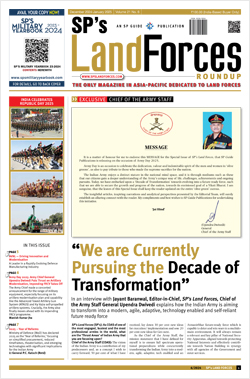
INDIAN ARMED FORCES CHIEFS ON OUR RELENTLESS AND FOCUSED PUBLISHING EFFORTS

The insightful articles, inspiring narrations and analytical perspectives presented by the Editorial Team, establish an alluring connect with the reader. My compliments and best wishes to SP Guide Publications.

"Over the past 60 years, the growth of SP Guide Publications has mirrored the rising stature of Indian Navy. Its well-researched and informative magazines on Defence and Aerospace sector have served to shape an educated opinion of our military personnel, policy makers and the public alike. I wish SP's Publication team continued success, fair winds and following seas in all future endeavour!"

Since, its inception in 1964, SP Guide Publications has consistently demonstrated commitment to high-quality journalism in the aerospace and defence sectors, earning a well-deserved reputation as Asia's largest media house in this domain. I wish SP Guide Publications continued success in its pursuit of excellence.
- MoD initiates comprehensive review of Defence Acquisition Procedure 2020, pushes for defence reforms
- G7: The Swansong
- Kalinga Connect: South Asia to Polynesia
- Must Credit DRDO for Operation Sindoor, now what is next for defence R&D?
- The layered Air Defence systems that worked superbly, the key element of Operation Sindoor
- Operation Sindoor | Day 2 DGMOs Briefing
- Operation Sindoor: Resolute yet Restrained
Transform National Security Apparatus

The need to bring intelligence and geospatial information under the aegis of one single agency cannot be underestimated and should not be relegated to a later day. India must reach a base level to match its status as a regional power.
The security, economic progress and well-being of the citizens of a country is closely interlinked with what intelligence gathering capability the country’s establishment has. Intelligence plays a prominent role in the decision-making process of any organisation including the military and such geospatial intelligence is vital to the command, control, communications, computers, information, intelligence (C4I2) system. The technological revolution particularly in the field of information technology and 21st century challenges to security including expanding threat of international terrorism has forced governments’ world over to adopt organisational restructuring to cope with such threats. The emphasis is on state to state cooperation and exchange of information rather than pursuing an independent agenda since these threats are transnational, omni-present and can occur any time. The geographic database is vast; no more restricted to areas adjoining international boundaries and also includes own territory. Therefore, the amount of information that needs to be processed to filter meaningful intelligence is colossal. This makes exploitation of technology essential in order to facilitate real time intelligence. Conventional approach will not do since it will be time taking and resource consuming. Automated decision support systems can process and form a cohesive picture from large amount of data in fairly short span of time, thereby permitting retention of initiative. The aim of any such system should therefore be to fuse data from multiple and sometimes even unrelated sources to be able to produce a comprehensive intelligence picture dealing with all aspects of information.
Geospatial Intelligence
There are many definitions for geospatial intelligence. However, the most apt definition depicting the magnitude of the effort required to build a database of geospatial intelligence is by the National Imagery and Mapping Agency (NIMA), which defines it as “the exploitation and analysis of imagery and geospatial information to describe, assess, and visually depict physical features and geographically referenced activities on the earth.” This elucidates the type of database required by government agencies entrusted with the task of national security. The need for commanders at all levels to have access to maximum data pertaining to the topography and demography of an area of interest is well established. Transparent overlays with supplementary information placed over printed topography sheets have been in use for long and are just one example of this necessity. Computers and associated technology have ushered in the era of digital mapping where this supplementary data can be tagged to various terrain features, which can be displayed, queried or processed, based on the requirement without cluttering the base map.
The capability and capacity of any application based on a geographic information system (GIS) is dependent on the quantity and quality of data provided as input. A digitised cartography map needs enormous volume of attributed data before it can become suitable as a GIS input. While generally this data has been assumed to pertain to terrain feature only, a true GIS ready map should logically cover the complete spectrum of data required by various disciplines of geodetic science that has military value in assisting the operations. This definitely calls for inputs even from agencies other than those dealing with topographic survey in order to make it all encompassing. For example, it should assist in calculating the effects of certain type of munitions like incendiary, chemical or biological that cannot be calculated purely by use of standard two dimensional models since it also requires detailed knowledge of terrain in terms of type of forest, condition of the shrubs and metrological conditions, etc.
Infrastructure
To reinforce the above, the security forces will need to rely on all relevant agencies of the government in order to optimally exploit the available information in a geographic context. Stand-alone reliance can leave large gaps in intelligence which would be crucial at the time of critical decisionmaking. It is therefore essential that any agency entrusted with the task of producing geospatial intelligence should be multifaceted with representation from all agencies dealing with aspects of intelligence, cartography, oceanography, civic infrastructure creation, public utility/safety services and so on. Cartography in an urban environment is a challenging task since there is lack of natural features that can be selected as control points plus the problem of line of sight for surveying. The requirements of user, especially security forces, are also very demanding in an urban setup. Layout of the sewage system, the power and telephone lines/distributors, other communication infrastructure, traffic conditions at various time of the day, location of medical and health centres, the demography, location of trouble spots, ethnic/communal break up of population, architectural drawings of the buildings, etc are the disparate sources of information which can enable a commander in taking logical decisions in case of a crisis.
Post-9/11, the US undertook major restructuring of government agencies and formation of National Geospatial Intelligence Agency (NGA) by merging in it with elements of the Central Intelliegence Agency (CIA), Defence Intelligence Agency, National Reconnaissance Organisation (NRO), State Department, etc. the NGA’s mission statement being “provide accurate and timely geodetic, geophysical, geotechnical analysis and geospatial intelligence information to support national security, department of defence, and intelligence objectives,” it is undoubtedly a major arm of the US Government assisting in implementing the national goals of USA. Other major nations too are restructuring to establish agencies dealing with this important aspect of intelligence. One may argue that USA is a global power and requires much larger database of spatial intelligence to support its foreign policies and its military deployed at various parts of the globe. While we may not draw comparisons with the US in terms of infrastructure at this stage, we will surely have to reach a bare minimum level to match our status as an emerging regional power including in the Indian Ocean Region (IOR). For production and analysis of data required as base for geospatial intelligence, numerous agencies are involved. This would include high resolution imagery products, elevation data through ground/ air/space based survey, electronic intelligence (ELINT) and human intelligence (HUMINT) assets, cartography data, inputs from agencies dealing with internal security, urban and rural development agencies, forest management agencies, intelligence community and so on. It is only when the seemingly unrelated events collected individually by these agencies are merged, a comprehensive intelligence picture in the geographic domain can emerge.


