

INDIAN ARMED FORCES CHIEFS ON
OUR RELENTLESS AND FOCUSED PUBLISHING EFFORTS
SP Guide Publications puts forth a well compiled articulation of issues, pursuits and accomplishments of the Indian Army, over the years

I am confident that SP Guide Publications would continue to inform, inspire and influence.
My compliments to SP Guide Publications for informative and credible reportage on contemporary aerospace issues over the past six decades.
- Interim Defence Budget 2024-25 — An Analysis
- Union Defence budget 2024
- Indian Army: In quest of greater firepower and policy recommendations for gaps
- Indian Army Annual Press Conference 2024
- 6G will transform military-industrial applications
- Tata Boeing Aerospace Delivers 250 AH-64 Apache Fuselages, Manufactured in India
ISR: The Essential Force-Multiplier
We are in a state of perpetual conflict, which has become a global phenomenon with many nations engaged in asymmetric wars. The new war paradigm demands integrated and networked decision support systems with space, land, surface and sub-surface sensors with state-of-the-art weapons and equipment whose potential requires optimum utilisation and synergy to inflict maximum damage on the enemy.
Intelligence, surveillance and reconnaissance (ISR) is the coordinated and integrated acquisition, processing and provision of timely, accurate, relevant, coherent and assured information and intelligence to support commander’s conduct of activities. Land, sea, air and space platforms have critical ISR roles in supporting operations in general. ISR encompasses multiple activities related to the planning and operation of systems that collect process and disseminate data in support of current and future military operations. By massing ISR assets, allowing a period of immersion, developing layering and cross cueing of sensors, an improved clarity and depth of knowledge can be established.
Intelligence
The sources of intelligence are multifaceted that encompass human intelligence (HUMIINT), technical intelligence (TECHINT), signal intelligence (SIGINT), open source intelligence (OSINT), etc—all cumulating into all source intelligence. The advantages of HUMINT at the strategic, operational and tactical levels are not very well understood. It is well known that when I.K. Gujral was the Prime Minister, the government had banned deployment of HUMINT sources trans-border. Ironically, successive governments did not reverse this decision and so HUMINT has been moribund in India ever since giving automatic advantage to our adversaries. Even the Defence Intelligence Agency (DIA), which has a mandate to operate trans-border human sources is denied permission to do so and is directed to rely solely on TECHINT.
Reliance on TECHINT alone is wholly inadequate. The Americans realised this and the US Central Intelligence Agency (CIA) was taken completely by surprise when the Pokhran II tests happened. That is the reason their Special Forces and proxies have been operating in Iran for the past eight years. We are unwisely spending crores of rupees on TECHINT while spending relatively nothing on HUMINT. This is the reason we are unable to strategise and cope with irregular and asymmetric threats—both national and transnational.
At the national level, the Multi Agency Centre (MAC ), the National Intelligence Grid (NATGRID) and the National Counter Terrorism Centre (NCTC) are efforts to synergise intelligence even though NCTC has not earned consensus because of genuine fears by states of the Centre misusing its powers. In military terms, acquisition of intelligence or information will depend on a plethora of sensors including HUMINT, processing it speedily and disseminating it in real time or near real time at required levels.
Surveillance and Reconnaissance
Surveillance is the monitoring of the activities and the changing information on ground. It is essential in terms of own response particularly in view of telescoped time frames needed for decision-making. Surveillance has many applications from the operational and strategic to the tactical level. Today, computers, telephones, cameras, social network analysis, biometrics, aerial means, satellites, humans, identification of credentials, global positioning system (GPS) and a host of other devices are all being used for surveillance.
Reconnaissance is the military term for exploring beyond the area occupied by friendly forces to gain vital information about enemy forces or features of the environment for later analysis and/or dissemination.
In the military, surveillance and reconnaissance (SR) encompasses binoculars, long-range devices like spotoscopes, night vision devices, weapon sights, HHTIs, radars of all types, unmanned aerial vehicles (UAVs) and micro air vehicles (MAVs), aerial, surface and sub-surface platforms and satellites. The Army is moving towards better surveillance and target acquisition equipment.
Why ISR?
Information is collected on the battlefield through systematic observation by deployed soldiers and a variety of electronic sensors. Surveillance, target acquisition and reconnaissance are methods of obtaining this information. This is important as it recognises the importance of taking the information from all of the sensors and processing it into useful knowledge. The intelligence data provided by these ISR systems can take many forms, including optical, radar, infrared images or electronic signals. Effective ISR data can provide early warning of enemy threats as well as enable military forces to increase effectiveness, coordination, and lethality, and the demand for ISR capabilities to support ongoing military operations has increased.
Importance
We are in a state of perpetual conflict, which has become a global phenomenon with many nations engaged in asymmetric wars. The new war paradigm demands integrated and networked decision support systems with space, land, surface and subsurface sensors with state-of-the-art weapons and equipment whose potential requires optimum utilisation and synergy to inflict maximum damage on the enemy. The key to success will lie in attaining higher levels of net-centricity; effective command and control across the force; an accelerated decisionaction cycle; and an ability to conduct synergised operations simultaneously within the defence and security establishment. Command, control, communications, computers, intelligence, information, surveillance and reconnaissance (C4I2SR) systems act as important force multipliers for commanders at all levels. We need C4I2SR to create positive asymmetrical capabilities and comprehensive competitive edge over adversaries.
Military Scene
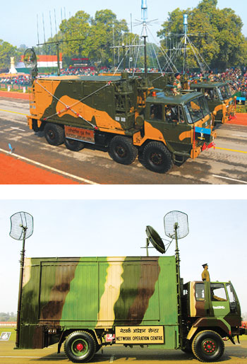
The Indian military is expected to induct radars worth over $8.5 billion in the next decade. Various indigenous developmental projects for radars and associated equipment as well as international acquisitions are taking place. Indigenous projects include development of active electronically scanned array (AESA) radar to be fitted on the proposed LCA MK II as well as a unique ‘Through Wall Imaging Radar’, both being developed by the Electronics and Radar Development Establishment (LRDE), Bengaluru. India has initiated integration of the indigenously built airborne early warning and control (AEW&C) system with the Brazilian Embraer EMB-145 aircraft which India is acquiring. The EMB-145I aircraft has been modified to carry the Indian-made active array antenna unit (AAU) mounted atop the plane’s fuselage. In addition, new generation of multifunction radars which can be integrated with any weapon system to provide surveillance, early warning, interception guidance and raid assessment are also being developed. These include a medium-power radar (Arudra), a low-level transportable 150-kilometre radar and a synthetic aperture radar. These radars will be broad so that they can be integrated into any weapons system.
DRDO is also developing 3D radar systems: the Central Acquisition Radar (CAR) for use with Akash SAMs; “Rohini” radar is the Indian Air Force (IAF) variant and the “Revathi” is for the Indian Navy. A third variant, known as the 3D tactical control radar for the Indian Army is also being manufactured. The US defence and aerospace major Raytheon is also talking to the IAF regarding airborne surveillance and reconnaissance radars that would be used along India’s borders. Raytheon has received two requests for information (RFIs) from the IAF but India has not decided whether to go for an AESA system or a mechanically scanned arrangement. Meanwhile, the Indian Navy has issued a RFI for 3D radars to enhance the surveillance capability of warships. The 3D radars will be deployed on ships more than 3,000 tonnes to provide 360-degree surveillance to detect aircraft, helicopters and incoming anti-ship missiles.
No new radars and UAV s have been inducted by the Indian Army. The move to identify and induct MAV s, that have already emerged as veritable force multipliers in other armies, has not progressed much predominantly since the Infantry has been focused more on the Futuristic Infantry Soldier As a System (F-INSAS). Meanwhile, the Defence Research and Development Organisation (DRDO) is designing a range of MAV s (Black Kite, Golden Hawk and Pushpak already developed). There are indigenous products in the market like the ‘Netra’ by Idea Forge, a spider-like MAV suited for all types of operations including counterterrorism and counter-insurgency, and the MAV with an infrared sensor developed by the Aurora Integrated System.
With respect to C4I2SR, the military has yet to evolve a NCW doctrine which should have been the start point to develop the NCW architecture. Non-merger of HQ Integrated Defence Staff (IDS) into the Ministry of Defence (MoD), lack of operational authority of former and void of a Chief of Defence Staff (CDS) have contributed to this. Neither voice or data networks nor radio communications of the services are interoperable to the desired degree. Radio sets differ in their frequency bands, wave forms and secrecy algorithms. Networks of the three services do not talk to each other. Common standards and protocols, mutually compatible database structures, development/deployment of interfaces between systems using disparate platforms and commonality of hardware have not commenced. Services cannot exchange individual UAV pictures and Air Force picture does not come directly into Army’s Operations Rooms. No common secrecy algorithm has been developed. Requirement of a military satellite was first projected by the Navy and later by the Army and Air Force. Adequate bandwidth is at premium. Military’s project, defence communications network (DCN), strategically connecting the Corps Headquarters of the Army and equivalents of sister services, Strategic Forces Command and HQ IDS, has been awarded to HCL Infosystems in early 2013 for development over two years. However, the project does not include development of requisite software; implying that the services and HQ IDS require developing software individually with attendant interoperability problems.
While the government has failed to appoint a CDS, the services have failed to establish Integrated Theatre Commands and Integrated Functional Commands. Void of an Enterprise GIS is glaring. Military survey products are primarily Google-based maps that hardly measure up to military requirements; 30 years behind meeting routine mapping requirements and large-scale mapping vital for operational information systems (OIS) not done at all. Defence Intelligence Agency is the central repository for all intelligence inputs pertaining to the three services but we are yet to integrate the aspects of topography with DIA. Within the existing setup, adequate resources in terms of remote sensing, ELINT payloads and cartography are not available to produce high quality fused data. A defence spatial data infrastructure (DSDI) is perhaps decades away.
The Army’s primary focal points for NCW are the tactical command, control, communications and information (Tac C3I) system and the tactical communications system (TCS ) aside from the management information system (MIS) and GIS. Tac C3I system providing upward connectivity up to Corps HQ level comprises the artillery command, control and communications system (ACCCS), air defence control and reporting system (ADC&RS), battlefield surveillance system (BSS), battlefield management system (BMS) and the command information decision support system (CIDS), latter integrating all. Tac C3I will also integrate the electronic warfare system (EWS) and electronic intelligence system (ELINT) but this is distant in the absence of common standards, structures, exchange formats and protocols. Upward connectivity from Corps HQ to Army HQ level is to be provided through the army strategic operational information dissemination system (ASTROIDS) sanctioned in 1995 with Institute of System Studies and Analysis (ISA), DRDO, as the development agency, but has been recently foreclosed lacking requisite software and faulty security overlay. RFI for a fresh project is under preparation.
Fielding of the CIDS pan-Army will likely take another seven-eight years. Being the hub of the Tac C3I, this will delay any measure of net-centric capability in the Army. Development of the BSS too has been unduly delayed since it is linked with the application of the CIDS under development. Contract for the ADC&RS was signed with BEL in March 2008 but the test bed is yet to materialise. Expression of interest (EoI) in respect of Army’s battlefield management system is likely to be issued shortly.
The TCS , approved by successive Defence Ministers in past should have been fielded in 2000. Currently, the Bharat Electronics Ltd (BEL) and a consortium of L&T, Tata Power SED and HCL Infosys Ltd have reportedly been selected by the government. Both selected parties will make the prototype systems and the best bidder will then execute the whole project. The Army also needs to focus on the human resources requirements for NCW. Aside from examining need for an IT cadre, niche areas like in cyber security and software development need long tenures that are lacking today.
Need for Efficient C4I2SR System
While the Army, Navy and Air Force are enhancing respective ISR capabilities, in terms of military’s NCW capabilities, we have not progressed much beyond taking sporadic initial steps. Tri-Service synergy is largely lacking. The Navy and Air Force have progressed with regard to intra-service NCW capabilities but the Army will take another decade-and-a-half to two decades to build required capacity. What we need is an efficient C4I2SR system.
SP's Land Forces - CURRENT ISSUE