


The insightful articles, inspiring narrations and analytical perspectives presented by the Editorial Team, establish an alluring connect with the reader. My compliments and best wishes to SP Guide Publications.

"Over the past 60 years, the growth of SP Guide Publications has mirrored the rising stature of Indian Navy. Its well-researched and informative magazines on Defence and Aerospace sector have served to shape an educated opinion of our military personnel, policy makers and the public alike. I wish SP's Publication team continued success, fair winds and following seas in all future endeavour!"

Since, its inception in 1964, SP Guide Publications has consistently demonstrated commitment to high-quality journalism in the aerospace and defence sectors, earning a well-deserved reputation as Asia's largest media house in this domain. I wish SP Guide Publications continued success in its pursuit of excellence.
We need to quickly make up for the years lost in procrastination and starving the military and the Army in particular of funds. The brutally-suppressed local movements of the Gilgit-Baltistan region and PoK can be exploited, if our government has the political will and the sagacity to think and plan for the long-term.
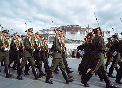
We have two major adversarial relationship with our neighbours – China and Pakistan. Both are related to our international borders in one way or another and both are legacies of the British in India. In the case of China, the British colonial power gave only passing importance to India’s borders with Tibet and China. Although they wanted the continuance of Tibet as a buffer state between India and China, they never placed it at the same level as the so-called Great Game—the fear of Czarist Russia initially and later the Soviet Union getting access to the warm water ports of the Indian Ocean. They did make an attempt in 1913-14, when a tripartite treaty between British India, China and Tibet was negotiated at Shimla, which established the alignment of the border between British India and Tibet in the eastern sector. The McMahon Line was drawn by the British negotiator, Henry McMahon on a small scale map, with a broad-nib pen and was attached to the agreement. All three representatives initiated the agreement, but it was not ratified by China and the border was never demarcated.
In the west too, the border between the erstwhile princely state of Jammu and Kashmir (J&K) with Tibet as well as the small portion with the Xinxiang province of China was left vague and was referred to as ‘undefined’ and treated as a traditional border, implying that both sides could cross it at will for grazing cattle, religious pilgrimages or trade. Soon after the communists came into power in China, Tibet was invaded and annexed by China. China also constructed a road in the west, in the Aksai Chin area (claimed by India) in the 1950s, linking its Xinxiang province with Tibet and presented it as a fait accompli to India and the world.
After fighting a war in 1962, the two countries are negotiating for decades to come to a resolution about the border, but have not succeeded, mainly because it suits China to continue with an uncertain border that can become a cause célèbre whenever China feels that it is in its interest. China is in illegal occupation of 40,000 sq km of Indian territory in the west. In addition, it is coveting additional territory in the eastern sector.
In the case of Pakistan, although the international border with India has been demarcated, the line of control (LoC) and the actual ground position line (AGPL) in the state of J&K and in the Siachen Glacier area respectively continue to be militarily active and flare up at the least provocation. The LoC (modified version of cease fire line) came about when Pakistani troops were thrown back by the Indian Army from a large area of J&K, but when a ceasefire came into force in January 1949, some parts of the state remained with Pakistan. These are now known as Pakistan occupied Kashmir (PoK) and the Gilgit-Baltistan area.
The AGPL came into existence when the Indian Army thwarted a Pakistani plan to occupy the Siachin Glacier in 1984. Despite a number of attempts by the Pakistani Army to regain the Glacier, the Indian Army stands firm.
It can thus be seen that in case push comes to shove and the security situation deteriorates, India would find itself in the unenviable position of dealing with more than one front, which must be avoided by all means by our leadership.
With the recent reports of the presence of China’s People’s liberation Army (PLA) troops in the Gilgit-Baltistan areas of Pakistan, the situation for India has become even more sensitive in the Ladakh district of J&K.
Compulsions of Geography
While assessing the impact of the PLA presence in Gilgit-Baltistan, one needs to study the geography of the area in great detail. In the Ladakh region, India has been squeezed by both Pakistan and China over the years. China is under illegal occupation of 35,000 sq km area in the Aksai Chin area, as well as 5,120 sq km in the Shaksgam Tract.
In the west, Pakistan is in illegal occupation of 78,000 sq km of Indian territory. This includes the northern portion of PoK as well as the entire tract of real estate now known as Gilgit-Baltistan.
Gilgit-Baltistan is the northernmost political entity in Pakistan today. It borders Pakistan’s Khyber Pukhtunkhwa province (earlier NWFP) to the west; Afghanistan’s Wakhan Corridor to the north-west; China to the north and north-east; J&K state of India to the east and south-east and PoK in the south. It covers an area of 72,971 sq km and has an estimated population of 1.5 million. It is highly underdeveloped and is sparsely populated. A part of this area, called the Shaksgam Tract, was illegally ceded to China by Pakistan in 1963.
On the eastern flank, China is in illegal occupation of the entire area known as Aksai Chin. This has resulted in the reduction of the length of the border with Tibet from 2,615 km to only 1,568 km and brought Chinese troops much closer. It will thus be clear that the northern portion of Ladakh has been hemmed in from both the east and the west. In addition, the Shaksgam Tract under illegal occupation of China exerts pressure from the north.